


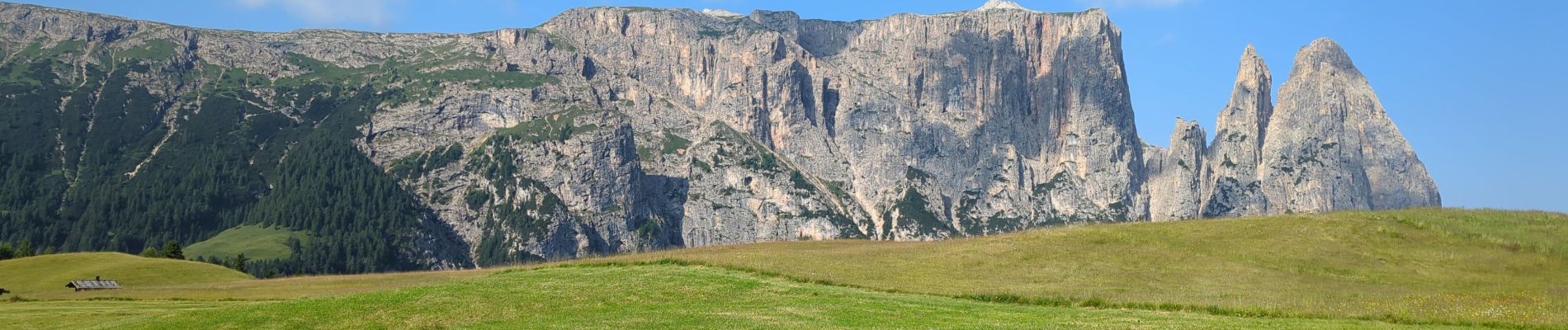
Schlern

VacheKiri67
User
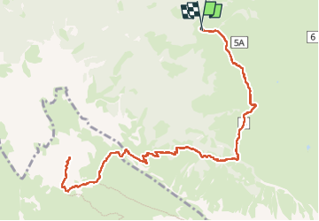


7h10
Difficulty : Difficult

FREE GPS app for hiking
 SityTrail
IGN / Geographical institutes
SityTrail Plus
The world is yours!
About
Trail Walking of 14.9 km to be discovered at Trentino-Alto Adige/Südtirol, South Tyrol, Kastelruth - Castelrotto. This trail is proposed by VacheKiri67.
Description
Faite le 18/07/2024.
D'après "Rother : Dolomiten 1 - 41 Schlern, 2564 m". Durée indiquée pour le circuit : 6h00. Parking gratuit à Spitzbühl. Attention la route d'accès est fermée de 9h à 17h. Prendre le télésiège (8h30-17h).
Le Schlern est un sommet emblématique du Seiser Alm.
La randonnée est magnifique.
Il faut bien gérer sa montée dans la partie rude des lacets avec de hautes marches de pierre. La suite est beaucoup plus abordable. Bonnes chaussures indispensables.
https://www.seiseralm.it/de/aktivurlaub/sommerurlaub/wandern/geoeffnete-bergbahnen.html
Photos


62 photos in total. Please click on a photo to see them all in the gallery.
Positioning
Comments